|
|
Kamchatka:
where the Earth bares its soul
Maps
of Kamchatka
 |
|
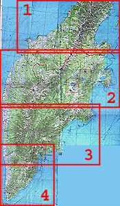
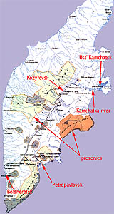
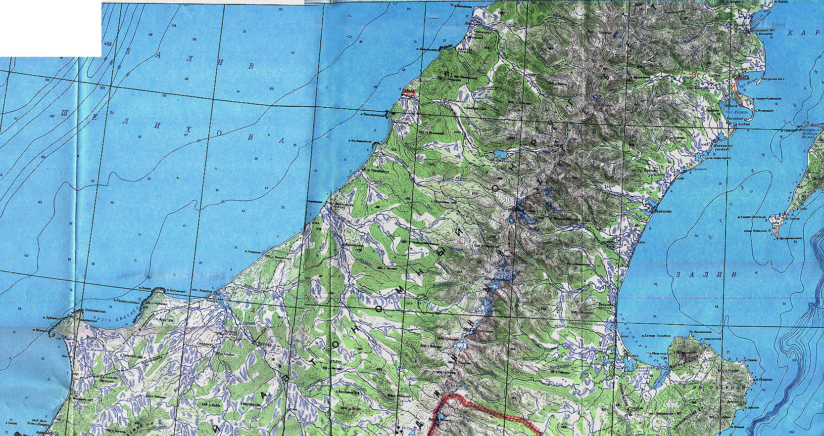
One
of the best physical-geographical maps of the Kamchatka
peninsula. WARNING: all names and words on this map are in Russian.
The
scale is 1:1 000 000.
Part 1: the northern part of the Kamchatka peninsula.
Size: 1,1 Mb, 1665x882 pixels. To load this part of the
map, click here.
Part 2: the north and central part of the peninsula with
volcanoes Kluchevskoy and Tolbachik. Size: 1,6 Mb, 2000x918
pixels. To load this part of the map, click
here.
Part 3: the central and south part of the peninsula
with Petropavlovsk-Kamchatsky.
Size: 1,3 Mb, 1645x1002 pixels. To load this part of the
map, click here.
Part 4: the southern part of the peninsula with Petropavlovsk-Kamchatsky.
Size: 830 Kb, 888x1050 pixels. To load this part of the
map, click here.
|
|
|
|
 |
|
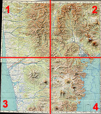
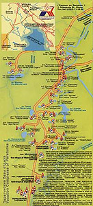
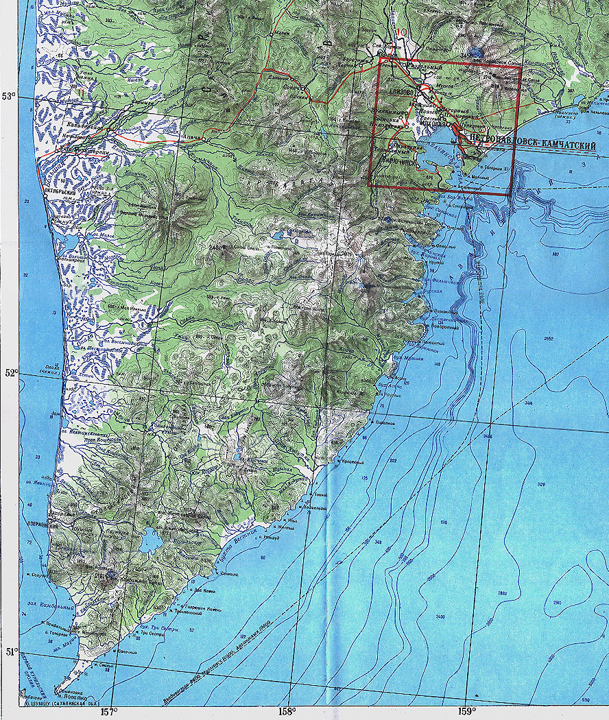
Excellent
map of Petropavlovsk-Kamchatsky area and beyond. WARNING: all
names and words on this map are in Russian.
The
scale is 1:500 000 (see the borders of the map).
Parts of the map overlap.
Part 1: Size: 507 Kb, 1000x1052 px. To load this
part of the map, click
here.
Part 2: Size: 577 Kb, 1000x1110 px. To load this
part of the map, click
here.
Part 3: Size: 745 Kb, 1000x1214 px. To load this
part of the map, click
here.
Part 4: Size: 698 Kb, 1000x1231 px. To load this
part of the map, click
here. |
|
|
|
 |
|
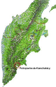
Physical-geographical
schematic map of the Kamchatka peninsula. Mountain ridges are
well distinguished.
Size: 120 Kb, 595x928 pixels.
To load this map, click here. |
|
|
|
 |
|
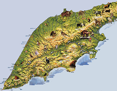
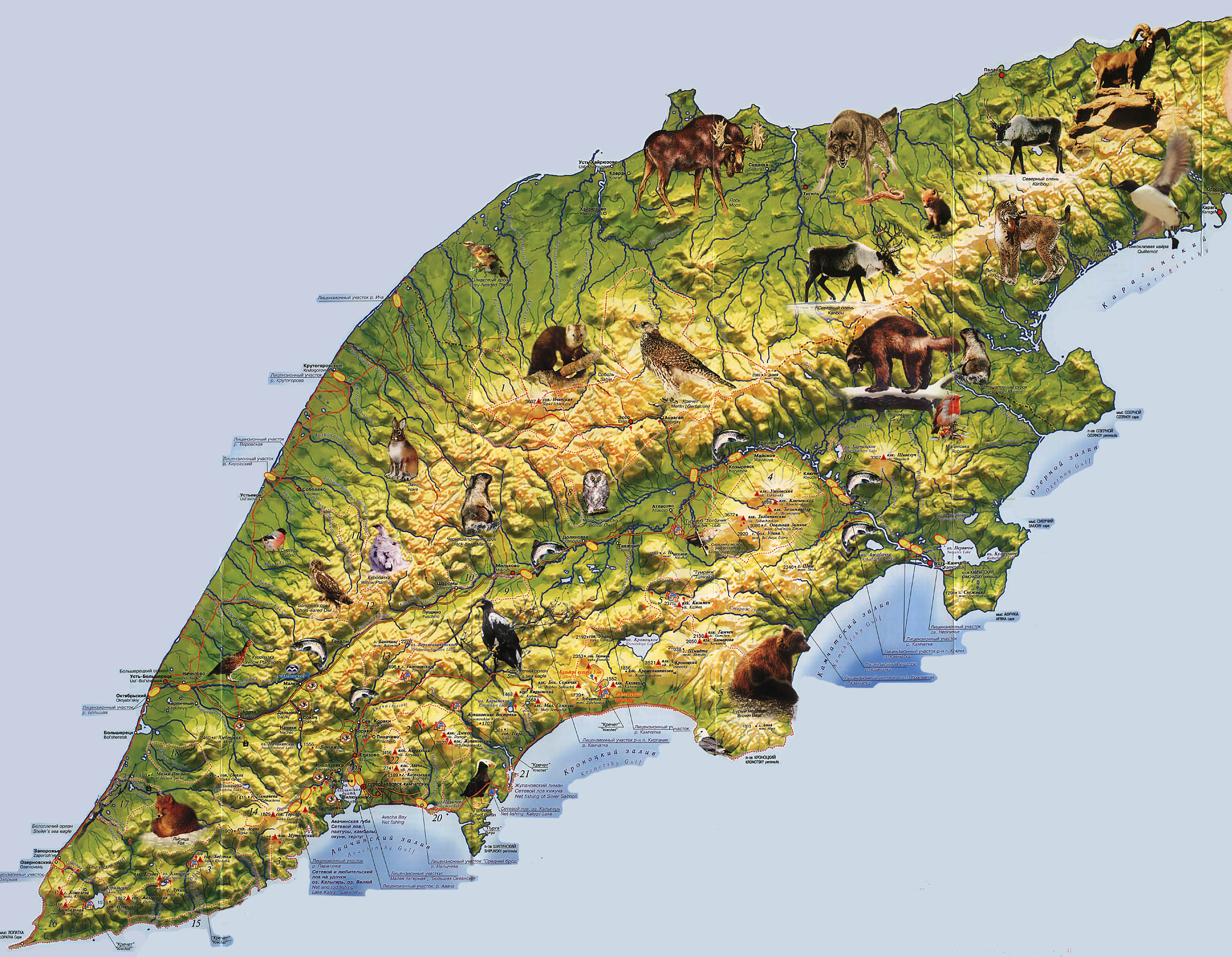
Very
particular map of Kamchatka with many geographical objects named
both in Russian and in English and places for fishing and hunting
shown.
Size: 880 Kb, 1852x3896 pixels.
To load this map, click here. |
|
|
|
 |
|
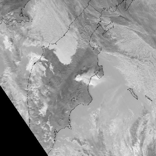
View
of Kamchatka from space.
Size:
60 Kb, 512x512 pixels.
To load this map, click here. |
|
|
|
 |
|
Geographical
scheme of the Kamchatka region.
Size:
294 Kb, 570x1069 pixels.
To load this map, click here. |
|
|
|
 |
|
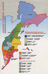
Administrative
scheme of the Kamchatka region.
Size: 122 Kb, 600x927 pixels.
To load this map, click here. |
|
|
|
 |
|
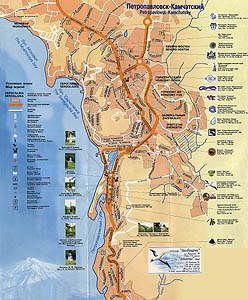
Scheme
of Petropavlovsk-Kamchatsky.
Size: 710 Kb, 1024x1112 pixels.
To load this map, click here. |
|
 |
|
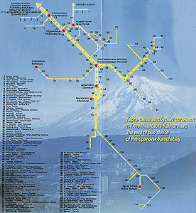
Transport
scheme of Petropavlovsk-Kamchatsky.
Size: 756 Kb, 1500x1817 pixels.
To load this map, click
here. |
|
 |
|
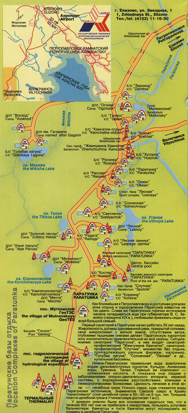
Map
of Paratunka.
Size:
251 Kb, 600x1319 pixels.
To load this map, click here.
|
|
|
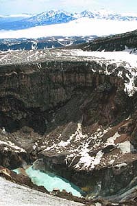
Crater
of the Gorely volcano with the lake in it
|
Wild
Russia / Neizvedanny Mir Company
Saint Petersburg, Fontanka embankment, 59
+7
812 703-3215
+7
812 703-3216
+7
812 703-3249
Email:
info@wildrussia.spb.ru
|

